Aloe Route

Gran Canaria
San Bartolomé de Tirajana

· Localitation: SouthCentral
· Area: 333 km²
· Habitants: 54.932 (2016)
May
· Humidity: 10%
· Temperature: 26º / 16º
· Precipitation: 200 mm
Gastronomy
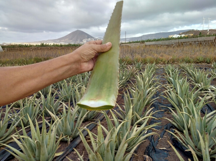
Discovering the environment where these Aloe Vera plantations are
cultivated is a gift that can only be appreciated through walks on their
lands. Crops hidden between palms and sharp cliffs. It is a sinuous
road that leads to these crops of Aloe Vera, full of color in spring and
ocher during the summer. From the crops we can see the high mountains
of the summit, its hazards caressing the clouds and a palm grove
surrounded by the white houses of the town of Santa Lucia and the
so-called "thousand palms of the valley". The Canary Islands have a
climate suitable for the quality of Aloe Vera, thanks to its
flexibility, to the cooling effect of the trade winds. The scenery is
unique!
From the sinks and ancient Egyptians we get documents about
their use. Nowadays it is used more and more, for both ends as
gastronomic, as curatives, as cosmetics. It has been used to treat a
wide range of conditions. The wide spectrum of its functions make it a
multivalent remedy. For internal use it is usually taken a tablespoon of
juice before meals. It can be mixed with fruit juices or with honey,
while we take it in salad. It is an excellent natural antiseptic that
penetrates easily into the skin and tissues. It acts as an anesthetic,
calming pains, has a great bactericidal activity, which destroys
numerous types of virus, highly nutritive, favors normal cell growth,
hydrates the tissues and acts as an antipyretic. To avoid sunburn, Aloe
gel should be applied at least 20 minutes before exposure to sunlight.
Like "after sun" it is second to none. In case of oral problems, sores,
extraction wounds, gingivitis or stomatitis, the gel or extract will be
kept in the mouth for as long as possible and keeping it in contact with
the affected area.
In this tour you can taste the freshness that Aloe Vera produces on your skin and taste it in a fruit juice.
All routes include tasting, hiking, picknick, transportation, insurance and guide.
Hike - Pilancones ParK
The
pinewood of its summits constitutes a habitat in good state of
conservation where the majority of its poultry population is
distributed, reason why it has been included in the network of special
zone for protection of the birds of the EU. At the base of these summits
are located some caves of ethnographic value. The park plays an
important role in hydrological catchment. In the higher parts the Pino
Canario predominates. Among the most outstanding advantages of the pine
forest are the maintenance of atmospheric humidity, it acts as a sink of
C02, it avoids erosion and recovers springs. In the lower levels, below
830 m, we can find among other varieties: Opuntia (cactus), Euphorbia
(spurge) and Dracaena (drago). From the terraces of Los Juncos with
steep slopes and isolated topographically we contemplate exceptional
panoramas of the most eastern part of the park, with the Degollada de
Manzanilla and Rosiana, between Morro del Guanil and Montaña de la
Negra. The park plays an important role in soil protection and aquifer
replenishment. In the south area prey are abundant, some of them of
great dimensions.
Accidentada
topography in whose interior are small hamlets like Ayagaures and Los
Vicentes, finding places like the Cross of Agustina, with a green
tonality is very unique. We speak of an enclave with a combination of
colors and aromas typical of the sunrise, where we recreate our sight in
a succession of small plateaus, crossed by ravines. The small springs
that dot the trail are easily recognizable, because of the greenness of
the juncalillos that grow in its channel, located where they end up
steep slopes.
Choose the route that best suits you
Level 1
Distancie: 3,5km
Slope: + 200m / - 100mEasy
Level 2
Distancie: 7,5km
Slope: + 400m / - 200mMedium
Level 3
Distancie: 12,5km
Slope: + 500m / - 350mHigh
Aloe Route


